Map Reading Basics
MAGNETIC COMPASS DIRECTION (Bearing) / AZIMUTH: What a magnetic compass reads.
You have a choice with most computer sun position programs to read out in magnetic
or true compass azimuth/directions. A problem arises when you want to apply
MAGNETIC compass information to maps laid out in TRUE compass direction. .
DECLINATION: The difference between MAGNETIC and TRUE compass directions. If
the magnetic compass points right (east ) of true north, the declination is
called EAST declination, if left (west) it is called WEST declination. (Note
there are many others uses of the terms declination. Deviation usually means
local magnetic errors. If your compass has declination adjustment ability, your
instruction book will explain how to adjust your compass to read "true" directions.
If your compass is not adjustable you will have to make the corrections suggested
in the instruction book.
GRIDS are reference lines parallel to longitudes and latitudes that run up and
down and side to side on a map. Not all maps have them. You can add them to
aid in orienting your map to north. With parallel rules you can draw a line
through your position and find true north.
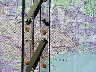
Parallel Rules on Map
MAP SCALES. A large scale map means it shows much detail of a small area. These
maps are necessary for orienting yourself exactly in a location and finding
the direction of objects, exact street directions or sunrise or sunset directions.
Small scale maps that cover much larger areas and are good for seeing adjoining
detail that is not on large scale maps. You could determine that the sun would
rise or set over the land instead of the water.
MAP BOOKS are easier to handle than larger sheets, but often the details you
want are on two or even 4 pages. Sometimes it is worth the time to copy and
then paste some of these sheets together for areas that you often work in.
Get a VARIETY OF MAPS of your area or any area that you will be working in.
1. You can compare them with each other for accuracy; and if roads run exactly
north and south as many newer roads and streets do. 2. Checking what is not
included in the large detail map is important. Maybe there is a peninsula or
an island that would interfere with getting a shot of a sun ball over the water,
such as in Oxnard California. A full size map of California will lack the detail
you might need. A map of only Southern California is better. 3. There are details
that change with time; river paths, sand spits, new roads, roads abandoned,
buildings, access, and details intentionally left off maps. Tourist maps often
lack accuracy and correct direction orientation. Tourist and car rental company
maps such as in Hawaii exclude areas and roads they don't want you to know about.
If using the Thomas Bros. Map books or others, a separate smaller scale (covers
a larger area) is useful.
One very handy small scale (large area) map are the Sectional Aeronautical Charts
used by pilots. They represents mountains and other surface detail in an easy
to understand shading. They have recent magnetic declinations for different
areas. They have control tower and pilot's information frequencies. Many landmarks
not shown on other maps are included. Being a quite SMALL scale maps, accurate
street directions measurements are not possible. Latitude and longitude lines
are very accurate. These maps also help show how flat maps of a round earth
are made. The scale is1:500 000. Or 1 inch = 8 miles. These maps are frequently
updated and obsolete ones for navigation are destroyed. They might be available
from flight services free to students for study purposes.
Other valuable small scale maps and map books are the De Lorme series. They
have topographic contour information and land type shading. They are very valuable
to check for detail just outside a larger scale map. They are usually more up-to-date
than USGS topo maps. Their scale is 1 in. = 150 000 or 1 in. = 2-1/3 miles.
USGS TOPO MAPS
These 1:24000 scale (1 inch = 2000 ft) maps are the workhorses of maps. They
have great detail and can be used for orienting your location, locating landmarks
and sun position down to parts of a degree. Since these cover very small areas,
you would need many to cover large areas and handling them becomes a problem.
The De Lorme type map books are definitely the answer for larger areas in large
detail. Topos show elevations in contour lines which take some practice to learn.
There are many good books about this subject and we will not get into this skill.
USGS topos are not often updated so look at the dates on these maps.
I find National Forest Service Maps not as useful.
City and county maps are very useful.
The Thomas Bros. Los Angeles County map book has a scale of 1 in. = 2400 ft.
This is slightly smaller scale than USGS topo maps.
© Copyright 1999-2004 Ron Dexter. All Rights Reserved.